


Apps for practical use
When traveling around the seas in ancient times, sailors used only paper maps, compasses, sextants, and so on. But times are changing, the world develops really fast, and now we have many modern tools that make our sailing trips more comfortable.
In this article, we will discuss the main apps for tablets or phones, which greatly simplify the life of yachtsmen during sea voyages.
1. Navionics is, perhaps, the most popular navigation app in the world. Millions of skippers use it for maritime navigation.

The app is very simple and intuitive. Ten years ago, it was just a shell where you could load maps for navigation. Now, it is a powerful tool that, in addition to maps, includes weather forecasts, AIS, the ability to build and plan routes, information about marinas and anchorage, etc.
The app uses the same maps that the yachts’ navigation systems, so you can combine your app and the navigator on the boat. This is very convenient.
2. Blue Chart Garmin is a less popular navigation app than Navionics.

It has a slightly different interface, which has similar functions, but in some ways, surpasses Navionics. Garmin maps are different from Navionics maps, so it’s useful to have both of these apps on the yacht to compare and analyze the information when creating a route and to monitor the current navigation situation.
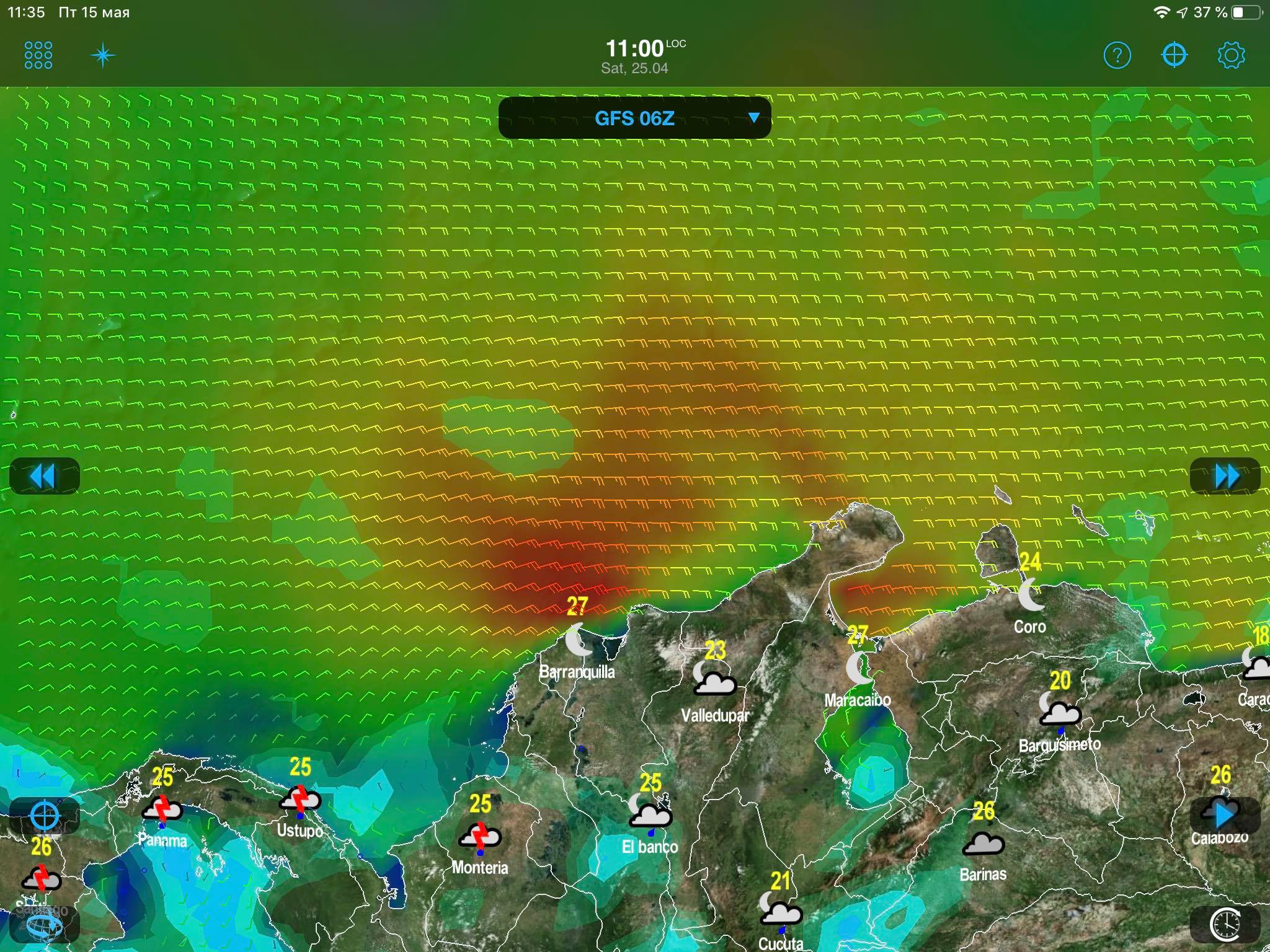
3. Windy is a weather app

There is Windy with a red logo and a blue one.

The apps have similar functions, so choose the one that will be more convenient for you. Both Windy maps use different forecast models, so it can be useful to have both apps to have a more complete analysis of the weather forecast.
4. Weather 4D is a weather app.
It has a very different interface from Windy. You can upload your route from Navionics, set the speed parameters of the yacht, and get a calculation of your optimal movement along the route. This is very convenient.
5. Aye Tides XL is an almanac of tides all over the world.

The app has a very convenient interface that provides visual information on the tide times, sunrise and sunset, and the moon position anywhere in the world. And you can have it a year in advance. This app is indispensable on a yacht if you travel not only in the Mediterranean Sea.
6. Marine Traffic — AIS (Automatic Identification System) app

This is the most popular app showing vessels with an AIS system on board. Even if you don’t have the AIS system installed on the yacht, with this app, you have a working tool to track the situation in the sea. There is one minus, though — you need to have the Internet onboard the yacht.
7. Navily is an app with information about yacht moorings around the world

It is very convenient to use to plan your route. You will know in advance all the information about anchorage and marinas along the route. There are reviews of yachtsmen who have already been there. Of course, there is some basic information about this in Navionics or Garmin, but Navily contains more detailed information.
So, we've discussed a small part of the main mobile applications that it is good to have on your phone/tablet when traveling on a yacht. Of course, there are many similar apps, and we cannot give information about each one.
In the second part of the article, we will talk about apps that help yachtsmen not to forget the theory and do some self-education.
Stay in touch and do not forget that apps are useful, but they won’t replace the ability to use a paper map and a direction finder, as well as the need to monitor the environment while sailing constantly.
Travel safely!
No comments, be the first one!